Exploring Peru’s Wilderness From the Air
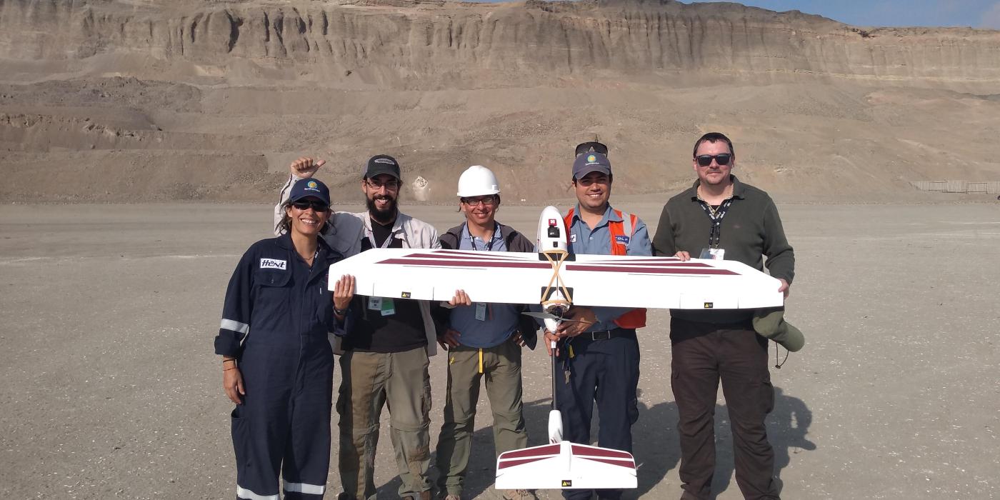
What’s that in Peru’s sky?
It’s a conservation drone!
The new super hero of Peru has just arrived, and it is here to fight deforestation, safeguard ecosystem restoration and protect nature along with its Smithsonian Conservation Biology Institute (SCBI) scientist sidekicks.
For more than 15 years, SCBI’s Center for Conservation and Sustainability has been doing research in Peru. Our focus is to better understand the dimensions of biodiversity and measure the impact of human industry and infrastructure on ecosystems. This research takes place in some of the most diverse places on earth: the Amazon, the Andes and the Humboldt Current Marine Ecosystem.
The diversity of life on earth is threatened by human development in multiple ways. Plants and animals are disappearing as a result of the degradation and destruction of natural habitats, climate change, the invasion of exotic species that replace native ones, and the overexploitation of some species for hunting, logging or fishing.
The resulting erosion of biodiversity and loss of natural habitats has, in turn, negative consequences on human societies. We depend on the numerous services provided by nature — things like clean air and water, pollination, natural medicines, climate regulation, or simply the inspirational sense of wonder we experience when walking in nature.
The application of cutting-edge technology has allowed scientists to address and answer questions that seemed intractable in the past. The latest addition to our suite of tools is a fixed-wing drone that is part of the Smithsonian’s Ecological Drone Program. We are excited for the new opportunities this super-powered flying hero brings to help us tackle conservation in Peru—from the sky!Continue Exploring
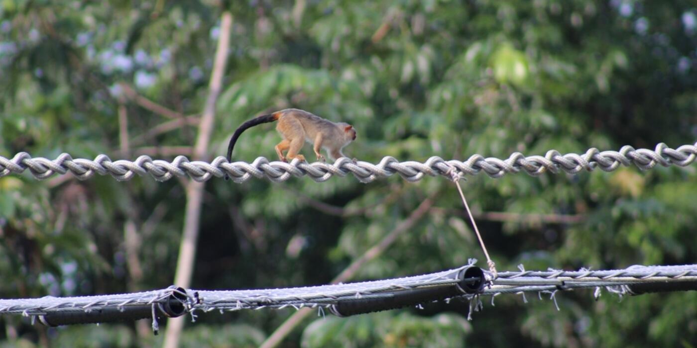
How Brazil’s Unique Canopy Bridges Are Saving Species ›
In this blog update, Dr. Fernanda Abra describes how a new system of canopy crossings is reducing road mortality among endangered primates in the Brazilian Amazon.

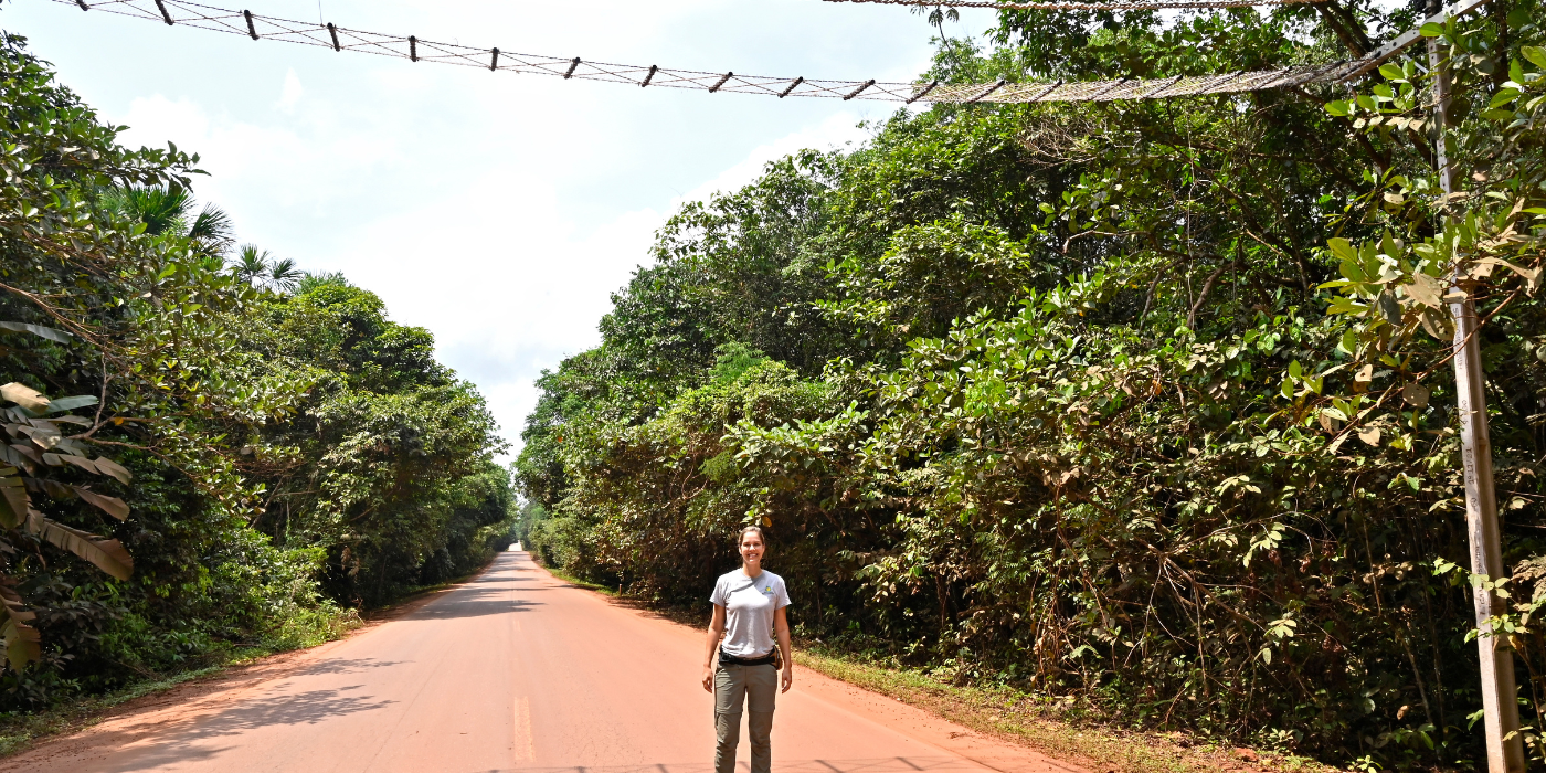
Smithsonian Project to Save Amazonian Primates from Road Impacts Wins U.K. Whitley Award ›
Smithsonian postdoctoral fellow Fernanda Abra was recognized for her pioneering work to build and monitor low-cost canopy bridges over Highway BR-174 in the Amazon rainforest, protecting tree-dwelling mammals from road...
Focus on the Future Fernanda Abra ›
Roads can be a dangerous challenge for terrestrial and arboreal wildlife. One scientist is trying to change that.