Tracking Devices
Scientists use different types of tracking technologies to determine the location of a bird at a given point in time. Depending on the technology, they can use this information to determine whether a bird is alive and how it moves through its environment. The type of technology scientists use depends on their research question and the limitations associated with the biology of the species they are studying.
| Tracking Technique | Definition | Information Generated | Spatial Accuracy | Retrieval | Minimum Bird Mass (g) | Lifespan of Device | Cost per Unit |
|---|---|---|---|---|---|---|---|
| Bird Band | A small, individually numbered metal or plastic tag that is attached to the leg or wing of a wild bird to enable individual identification. Colored bands are often added to enable identification without having to recapture the bird. By re-sighting (color band only) or recapturing (metal band) individuals, we can determine how long a bird survives and observe its movements. | Location and survival at recapture | Exact | Recapture of bird | N/A | Years | Minimal |
| PIT Tag | An electronic microchip that can be glued to a bird band, attached to a bird's leg or inserted surgically under a bird's skin. PIT tags require no batteries, so they can theoretically last for a bird's entire life. PIT tags can only be read a very short distance from receiving stations. | Time that bird was close to receiver | Exact | When animal passes by antenna or receiver | 0.9 grams | Years | $2 |
| Radio Telemetry | The technique of using the transmission of radio signals to locate a transmitter attached to the animal of interest. It is often used to obtain location data on the animal's preferred habitat, home range and to understand population dynamics. | Time and location when bird was close to receiver | 10 meters | When animal passes by antenna or receiver | 6.6 grams | Weeks to months | $100 to $200 |
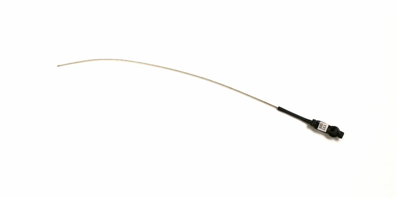
| Light-level Geolocator | A lightweight, electronic tracking device usually used in bird migration research to map migration routes, identify important staging areas and sometimes provide additional ecological information. A geolocator periodically records ambient light level to determine location. | Light level that can be used to infer latitude and longitude throughout time | 100 to 150 kilometers | Archival (requires recapture of bird) | 8 grams | >1 year | $200 |
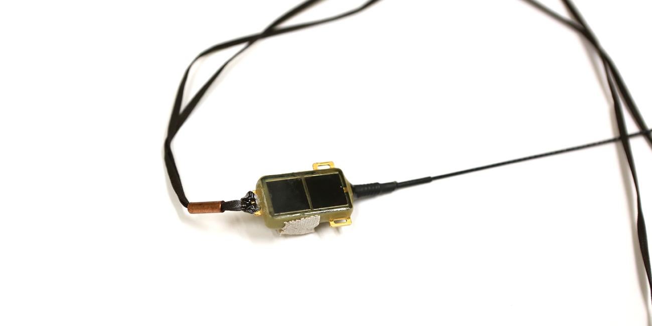
| Satellite Telemetry | A transmitter is attached to the bird. The transmitter sends its signal to an orbiting satellite. The satellite re-transmits the data to a receiving station, which researchers then access through their computer. | GPS location data throughout time | 250 to 1500 meters | Transmitted to satellites and sent to email, web or software in near real time | 116.6 grams | Months to >1 year | $3,000 to $7,000 |
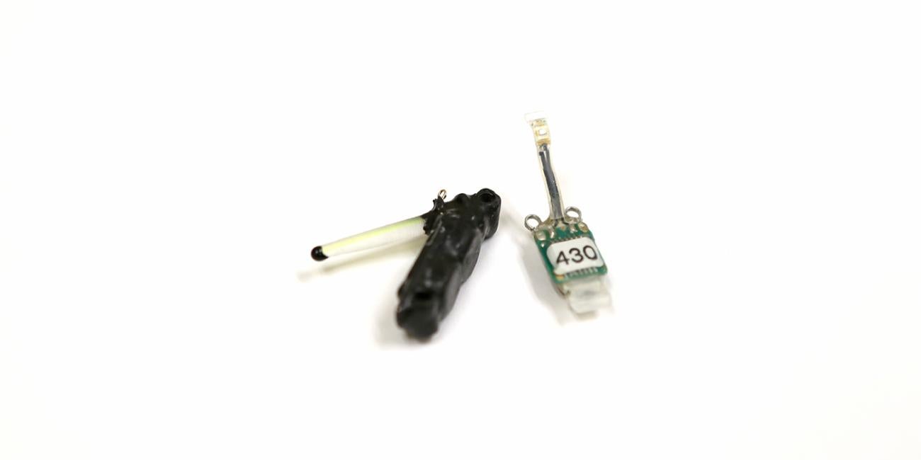
Click on the photos below to learn more about each tracking device:
What are Light-level Geolocators? ›
Learn more about light-level geolocators, tracking devices that use daylight to estimate location.

What are PIT Tags: Passive Integrated Transponders? ›
Learn more about PIT tags, tracking tags with an internal microchip that is activated when it passes a special antenna.

What is Bird Banding? ›
Learn more about bird banding, a tracking technique using aluminum or colored bands.
What is Radio Telemetry? ›
Learn more about radio telemetry, a tracking technology that utilizes radio signals.
What is Satellite Telemetry? ›
Learn more about satellite telemetry, a tracking technology that calculates location via satellites that orbit the Earth.